Thursday, June 30, 2022

Isolated shower/storm chance for the holiday weekend


The chance for rain and thunderstorms will return to northern Illinois and southern Wisconsin as we look towards the holiday weekend, but it won't be a complete washout and there should still be plenty of dry hours to get out and enjoy.

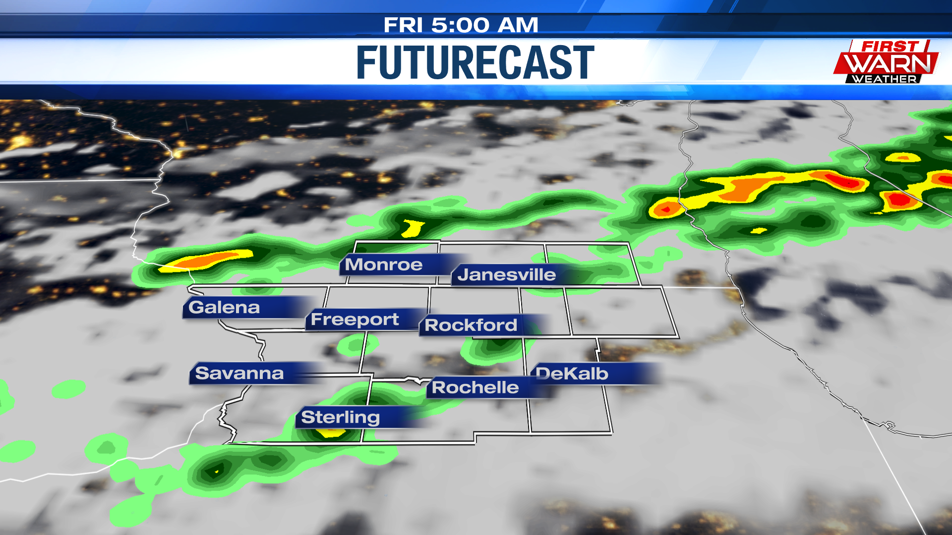
For the remainder of Thursday evening, skies will continue to fill with cloud cover as a cold front sinks south across the Midwest. Temperatures Thursday afternoon warmed into the upper 80s and low 90s, reaching 92 degrees in Rockford. Under the partly to mostly cloudy sky Thursday night, low temperatures will dip into the upper 60s - rising into the low to mid 80s Friday afternoon.

Friday morning will be our first chance for rain heading into the extended weekend as showers and a few thunderstorms are expected to develop along and ahead of the cold front. No severe weather is expected with the front coming through during the morning, but a few pockets of heavier rainfall are possible. As the cold front passes through early afternoon, an isolated shower or storm may still occur during as some moisture lingers around behind the front. It does appear that most areas remain dry, however, heading into Friday evening.


High pressure is quick to build in Saturday, but with the position of our jet stream overhead Saturday and Sunday, several loosely organized upper level disturbances are expected to move through the Midwest. This is known as a 'ring of fire' pattern. Heat and instability build under a strong ridge of high pressure where sinking air dominates and doesn't allow for the development of rain or thunderstorms. On the outer edge of the ridge and right along the heat dome, however, thunderstorms develop and follow the flow of the jet stream, feeding off of the heat and instability to the south. This type of pattern is very typical for July and August and often leads to more nighttime thunderstorm activity which produces very heavy rainfall and strong winds. With the heating of the day, a couple isolated showers and thunderstorms may develop this weekend. However, there looks to be many more dry hours than rainy/stormy ones through the weekend. High temperatures will warm into the middle and upper 80s.


The 4th of July itself may actually hold our best chance for rain through the weekend, which could come towards Monday evening and overnight. A little more of an active storm pattern looks to develop heading into next week with a ridge of high pressure building across the Plains, placing much of Wisconsin and Illinois under the favorable storm track for low pressure systems to move along. Timing these types of systems can often be difficult, especially several days in advance. But the latter half of Monday appears to have a slightly higher chance for rain/storm activity that could carry over into Monday night. While it's too early to cancel any plans for the day, you'll definitely want to pay close attention to the forecast for Monday. The rain and storm chance will remain with us into early next week.  

Windy & Hot Thursday Ahead, Few Storms Possible Early Friday

Windy Thursday:

Thursday calls for more suns. However, a tightened pressure gradient in between a high pressure system to the east and a cold front to the northwest will increase our winds by the mid-day hours. 

Winds will generally be out of the south or southwest, with gusts pushing 30-35 mph. That, along with the fact our ground is very dry, will elevate the fire risk across the region. 

To be safe, make sure to limit or even postpone any burning that you have planned as any fire can spread easily in these conditions. Ahead of the approaching cold front, high temperatures for a few will peak in the lower 90s. Thankfully, today's 90-degree weather is a one-day event.

Rain Potential Friday:

Clouds are expected to thicken up some overnight, with a round of scattered showers and t-storms arriving shortly before sunrise. 

Unfortunately, this doesn’t look like it will be a beneficial rain as the potential for a washout or even severe weather is highly unlikely. With that being said, it wouldn't hurt to have the umbrella on hand for Friday morning’s commute. 

Guidance shows tomorrow's rain making a quick exit before mid-day, allowing some sunshine to appear during the afternoon. Because the cold front occurs during the morning hours, highs will take a tumble from the lower 90s today to the lower 80s Friday.

4th of July Weekend:

Behind Friday's cold front, an area of high pressure takes over, allowing sunshine to return for a good chunk of the holiday weekend. Along with the dry weather does come a quick warm up as highs both Saturday and Sunday peak in the upper 80s. 

Forecast models continue to show a "backdoor" cold front sinking down from the north late in the day on the 4th. We'll likely need to keep an eye on this frontal boundary for the potential for scattered showers and thunderstorms. As I said yesterday, we're still a few days so of course the forecast will change as we inch closer. But if you have any big plans to celebrate the 4th, be sure to stay up-to-date with the forecast by downloading the First Warn Weather App!

Wednesday, June 29, 2022

Hot and windy Thursday; Rain returns Friday


Temperatures Thursday afternoon will be hot, but it won't be too humid as dew point temperatures are expected to drop into the low 60s, perhaps even mid to upper 50s, during the afternoon. Southwest winds will increase as a cold front sits to our northwest and high pressure sits to our southeast. Winds will gust as high as 35 mph throughout the afternoon and evening. This will help push temperatures into the upper 80s and low 90s throughout much of the area.

As a cold front approaches from the north and northwest Thursday night, cloud cover will gradually begin to increase. The front will cross southern Wisconsin and northern Illinois early Friday, bringing with it a chance for showers and thunderstorms during the first half of the day.


As the front sinks south by early afternoon, skies are likely to remain mostly cloudy during the day which may hold temperatures down into the upper 70s and low 80s. Right now the forecast high for Friday is 82 degrees. Heavy downpours are possible as the front moves through Friday morning, but rainfall totals don't appear to be more than half an inch. A slower moving cold front could increase the risk of thunderstorm coverage, as well as heavier rainfall into the afternoon. Right now, the threat for any severe weather appears to remain on the lower end. Skies will dry out by Friday night.

Sunny Stretch Continues, Cold Front Brings Rain Chances Early Friday

Sunny Stretch Continues:

As my weather director back in college always liked to say, "big bubble, no trouble". That's the perfect way to describe the weather here in the Stateline the past few days as a massive high pressure system has kept things under control. 

Despite the fact that a few storms from the northwest tracked into the region overnight, this quiet weather pattern is expected to stick around into the middle of the work week. 

Sun-filled skies are expected from start to finish, with highs climbing into the upper 80s. So, we end up a little warmer than the past few days. However, dew point temperatures remain comfortable, in the upper 50s and low 60s. 

Conditions remain quiet for the overnight hours, with a bit of a southwesterly wind kicking up by sunrise. The combination of this gusty warm wind and low relative humidity may bring an elevated fire risk for Thursday afternoon.

Fire Danger Thursday: 

If you can, limit or postpone any plans to burn until the 4th of July weekend. Winds at times could gust up to 30-35 mph, allowing any uncontrolled fire to quickly spread and become a big issue. 

Ahead of a weak cold front, temperatures for most peak in the lower 90s under a mixture of clouds and sunshine. Along with the jump in temperatures comes a small jump in humidity. Thankfully, nothing too significant.

Warmth Quick to Return:

 This cold front looks to arrive late Thursday night into early Friday morning, bringing with it our next shot at some rainfall. Showers and storms are likely to be scattered in nature, with accumulations remaining on the lighter side. 

Behind the frontal passage, temperatures fall by a few degrees, with highs peaking in the lower 80s.This cool-down is brief as warmer flow will be quick to return over the holiday weekend. Under plenty of sunshine, highs top out in the upper 80s both Saturday and Sunday. The one thing we'll have to keep an eye on for the 4th of July itself is the placement of a frontal boundary. Storm chances as of this morning remain low. However, there's still plenty of time for the forecast to change. 

Tuesday, June 28, 2022

Elevated fire risk midweek as temperatures warm


Temperatures Tuesday afternoon warmed into the low to mid 80s, reaching 85 degrees in Rockford. Skies were quick to turn partly cloudy late morning and early afternoon, but were also quick to clear during the evening. Winds will remain from the south Tuesday night holding temperatures in the low to mid 60s.

Wednesday will be a dry, but warm, afternoon as high temperatures climb into the upper 80s. Winds will increase even further following a warm front Wednesday night, gusting 30-35 mph during the afternoon Thursday. This will push temperatures into the low 90s Thursday afternoon. Despite the strong southwest wind during the day, dew point temperatures will remain in the upper 50s. This will cause relative humidity values to drop below 40% throughout much of the day, if not lower.


The combination of strong winds, high temperatures and low dew point temperatures could elevate the fire risk for Thursday afternoon. This means that any outdoor burning should be limited during the afternoon and evening as fires could spread quickly given the weather conditions and dry vegetation. Rain showers are set to move in with a cold front Friday.  

Monday, June 27, 2022

Shower chances return late Tuesday evening


High pressure will continue to control the skies Monday evening, and for much of the day Tuesday with temperatures warming back into the low to mid 80s. Winds Tuesday afternoon will turn more to the southwest, pulling in a little more moisture into the Midwest. While this will cause our dew point temperatures to rise, humidity will still remain at somewhat comfortable levels during the day.

A cold front sinking south across the Upper Midwest

will move through Wisconsin during the afternoon. Showers and thunderstorms are likely to develop ahead of the front north of the state line, with a few stronger storms developing by early afternoon. As the front continues to move south, clouds will increase throughout the evening, but much of our Tuesday is expected to remain dry.

The cold front will move closer to the Stateline after 9pm/10pm, which is when we could see our first few showers move across southern Wisconsin. Widely
scattered showers and isolated thunderstorms are possible towards Midnight across northern Illinois, but more locations are expected to remain dry than will experience rainfall Tuesday night. The cold front weakens quite a bit Tuesday night before lifting to the north during the day Wednesday. This will bring temperatures Wednesday afternoon into the upper 80s, to near 90 degrees. Skies will remain dry Wednesday afternoon.

Sunday, June 26, 2022

Rainfall running short as summer heat continues


Saturday's rainfall was much needed coming off of a week and a half stretch of dry, hot and windy weather. But the nearly inch of rain wasn't enough to bring up June's rainfall deficit which is now nearly two and a half inches below the monthly average. June is typically the rainiest month out of the year, picking up over five inches of precipitation.

The mostly dry stretch of weather looks to continue through the end of June as only a slight chance of precipitation appears to occur late Tuesday night. This will be with a cold front that sinks down from the north, bringing a better chance for showers and thunderstorms across central and southern Wisconsin. As the cold front weakens and washes out, it'll pull back north as a warm front allowing temperatures to rise into the upper 80s and low 90s Wednesday and Thursday. Winds will be gusty both days. Another cold front moves in Thursday night/Friday morning and will be our next chance for showers and thunderstorms heading into the holiday weekend.


The dry month continues the trend of an overall dry year, as March and April were the only months that ended with above average precipitation. Yearly precipitation stands at 13.78 inches which is 4.41 inches below the yearly average. We typically tend to see precipitation drop a little during the month of July before picking back up again in August.

The recent hot, dry and windy weather has really put a stress on some of the crops in the fields, as well as some local gardens. We may, however, see that pattern start to break down as the outlook for the beginning of July looks to favor a slightly higher probability for above average precipitation, at least through the first week to week and a half. It also favors a slightly higher probability for above average temperatures; a pattern that could lead to a little more active weather.

Sun-Filled, Comfortable Weather Pattern Slides in Behind Saturday's Rain

Saturday's Rainfall:

Yesterday's rainfall was just what the doctor ordered  as it's been quite some time since the Stateline has seen a soaking rain event. 

When it was all said and done, most if not all of the Stateline registered totals between .75" to 1", with Sterling topping the charts with a whopping 1.20" of rain. As of early Sunday morning, the cold front responsible for yesterday's rainfall is now to our south and east, leaving winds out of the west-northwest. This will allow our weather pattern to turn more quiet and comfortable for the end of the weekend and for the beginning of the upcoming work week. 

Breezy Sunday:

Sunday begins with plenty of sunshine, with temps landing in the mid to upper 60s. If you plan on stepping out the door early, be sure to grab your favorite pair of sunglasses. A few clouds and a bit of a breeze does develop by the afternoon.

West to northwest winds could gust up to 30 mph at times, with isolated gusts up to 35 mph. Otherwise, highs for most will peak in the upper 70s, making for a very comfortable and B-E-A-UTIFUL afternoon to be out and about. High pressure sliding into the central plains will keep conditions quiet overnight, with low temperatures falling into the mid to upper 50s. 

Slowly Warming Up:

Northwest flow carries on into the beginning of next week, resulting in another sun-filled and comfortable day for Monday. Once this high pressure system shifts to our east, winds will turn more to the southwest for Tuesday. This will help bring our daily highs up by a few degrees, with most landing in the lower 80s. 

Continued warming is expected into the middle and second half of next week as highs climb into the lower 90s by Thursday afternoon. As far as rain chances are concerned, they don’t exist until we see our next cold front swing in Thursday night into Friday morning. At this time, it doesn’t look like anything of significance as it looks like we'll be dealing with another weak frontal boundary. 

Saturday, June 25, 2022

Rainy Saturday, Dry and Pleasant Weather Moves in Sunday

Round One Moving In:

The first of potentially two rounds of rain is moving in from the west. If you are waking up early and have to be somewhere this morning, be sure to allow some extra time on the roads and have the umbrellas handy. 

Morning guidance shows this first wave sliding out by the late morning hours, allowing skies to clear a bit as we roll into the afternoon. High temperatures look to end up a few degrees cooler than the past few days, with most peaking in the low to mid 80s. Now, the amount of sunshine we see will help determine the potential for a second round this evening. 

Severe Threat:

Earlier this morning, the Storm Prediction Center shifted the Marginal Risk (level 1 of 5) south to include areas south of highway 20. Time-wise, the best chance for storms will be between 6PM and 11PM, with gusty winds, small hail, and frequent lightning being the biggest concerns. 

Rainfall totals should range between .25"-.50". Once storms move out and the cold front is through, rapid drying will commence turning skies partly cloudy by sunrise. Dry and pleasant weather takes over, with highs for a few failing to eclipse the 80° mark Sunday afternoon. It will be a it breezy behind tonight's cold front, with northwest winds peaking around 25-30 mph. With that being said, it's going to be a beautiful afternoon across the area. And the good news is, this pleasant weather pattern stretches into next week. 

Dry & Cooler:

The work week kicks off on a much different note than the previous. If you remember, last Monday featured a high temperature of 95°, followed by our first 100-degree day since July of 2012. 

This time around, the cooler air behind tonight's cold front will bring highs down to near-seasonable levels, with low 80s to start the new week. If that wasn't enough, high pressure slides in during the Sunday to Tuesday time frame, meaning plenty of sunshine is in the works. The only shots we have for some rainfall is an isolated chance Wednesday and Thursday, with the best chance coming in on Friday as a cold front slides through. 

Friday, June 24, 2022

Another Toasty Day, Rain Chances Return Saturday

Drought Increasing:

When you take into account the recent stretch of sun-filled skies and well-above average temperatures, it comes to no surprise that our drought situation has taken a step backward. 

According to yesterday's edition of the Drought Monitor, a majority of the Stateline is now seeing abnormally dry conditions. Unfortunately, signs of relief are little to none over the next several days as a dry weather pattern continues to dominate.

Another Toasty Day:

Friday starts off dry and comfortable, with temps sitting in the lower 60s. Winds on the backside of this high pressure system will be out of the south-southwest, allowing temperatures to climb back into the lower 90s this afternoon. 

If planning to be outside, be sure to have the sunscreen on hand as sunshine is expected from start to finish. Skies remain partly cloudy going into the overnight hours, with clouds increasing after midnight. Not too far behind will be a chance for a few showers and thunderstorms. 

Chances Return Saturday: 

Guidance continues to show Saturday's chances coming in two different rounds, the first bringing a wind and small hail threat. 

Earlier this morning, the Storm Prediction Center placed all of our northern Illinois counties under a Marginal Risk (level 1 of 5) for severe weather. This would be for any storms that may develop in the morning and then again in the early evening along the cold front. Chances extend into Saturday night, with conditions rapidly drying out on the backside of the front for Sunday. 

Cooler Times Ahead:

As my weather director always said when it comes to a long-lasting high pressure system, "big bubble, no trouble". Another high pressure system slides in behind Saturday night's frontal passage, allowing conditions to remain dry into next week. 

The cooler air that filters in will help drop our high temperatures by 5° to as much as 15°, with some struggling to make it our of the 70s Sunday afternoon. Plenty of sunshine is expected to follow, with highs climb back in the lower 80s both Monday and Tuesday. As far as rain chances are concerned, the only shot we have next week is an isolated chance Wednesday and Thursday. However, those chances as of this morning remain slim to none!

Thursday, June 23, 2022

Comfortable Weather Continues, Few Storms Possible Over the Weekend

More of the Same:

Wednesday felt a lot more comfortable thanks to the cooler, less humid air filtering in behind Tuesday night's frontal passage. 

High temperatures for most landed in the upper 80s, with the Rockford Airport just touching the 90-degree mark. While that does sound warm, dew points during the afternoon remained in the 50s. So the air didn't feel nearly as humid as Monday and Tuesday. Now, if you loved yesterday's weather, you'll be happy to know that more of the same can be expected for our Thursday. 

Thursday starts off with a few clouds, with temps sitting in the low 60s. Similar to yesterday, any clouds that are around after sunrise will give way to plenty of sunshine by the mid-day hours. 

With winds still remaining out of the west-northwest, expect highs to climb into the upper 80s, with dew points sitting in the upper 50s. All in all, it will be another perfect afternoon for a walk at the Sinnissippi Bike Path, to catch up on yard work, or to simply enjoy some ice-cream.

Late-Week Rain Chances:

The same high pressure system that keeps us dry today will shift to the east of the region by Friday morning. This will allow for an increase in not only our temperatures but also our moisture, resulting in a chance for showers Friday night into Saturday. 

Until then, our weather remains dry with mixed sunshine expected during the daylight hours. With the change in wind in mind, this will once again allow highs to eclipse the 90-degree mark Friday afternoon. Guidance shows a chance for a few showers in to early Saturday morning, with another chance arising with a cold front Saturday night. This chance could bring the potential for a few storms, some of which could end up on the strong to severe side. 

Earlier this morning, the Storm Prediction Center placed a good chunk of our western counties under a Marginal Risk (level 1 of 5) for severe weather. As of right now, it looks like damaging straight-line winds and large hail will be possible with the stronger updrafts. 

Once the cold front slides across the region Saturday night, a much cooler air-mass will filter in for Sunday and the beginning of next week. This will help drop our high temperatures from near 90° on Saturday to the lower 80s. Not only do we cool down, another area of high pressure takes control, bringing the opportunity for more sunshine into early next week.

Wednesday, June 22, 2022

Cooler, Less Humid Weather Follows First 100-Degree Day Since 2012

100-Degree Day Stats:

Welp, it FINALLY happened folks. For the first time in almost 10 years (3,262 days to be exact), the mercury at the Rockford International Airport touched the 100-degree mark. 

Not only did we manage to snap what looked to be an everlasting streak, but we also tied the 34-year-old record high set back in 1988. Now, relief is quick to follow. The same cold front that brought a line of showers and storms Tuesday evening is expected to also bring down our daily highs for the remainder of the week. 

Cooler, Less Humid:

With high pressure sliding over the Stateline, sun-filled skies are expected the next two days, with highs in the upper 80s. However, a northwesterly to northeasterly wind will blow, allowing for drier, much more comfortable humidity levels. 

So, that A/C unit that has been putting in the work over the last couple of days can finally take a rest. Also, it'll still be perfect weather for those that are planning to take a dip in the pool. 

 Overnight lows will also fall to a more comfortable range, with temperatures ranging from the low 60s tonight to the upper 60s Friday night. Another cold front is slated to slide through overnight Saturday into Sunday, bringing an even cooler round of air for early next week. I mean, we're talking highs in the lower 80s and overnight lows in the upper 50s. Now, that's more my speed! Unfortunately, the potential for a healthy, soaking rainfall remains low over the next 7 days.

Tuesday, June 21, 2022

Dangerously Hot Day Ahead, Much Cooler for Wednesday

Dangerously Hot Tuesday:

While it seems like forever ago, it was only last Tuesday that the Rockford International Airport made a run at the 100-degree mark. However, we fell short by a few degrees solely because our atmosphere contained too much moisture, resulting in dew points in the low to mid 70s. Why does that matter? Well, the higher the atmospheric moisture, the slower the air molecules move. 

For instance, dew point temperatures today look to range from the upper 60s to the lower 70s, so slightly lower than last Tuesday. This would give air molecules a bit more wiggle room to move around, allowing us to warm up more efficiently. That, along with the sunshine, a gusty southwesterly wind, and the dry state of the ground may allow temperatures to hit the 100-degree mark for the first time since July 17th, 2012. 

Heat Advisory:

Yesterday, the National Weather Service placed our three counties up in southern Wisconsin, along with Jo-Daviess, Stephenson, Winneabago, Boone, Carroll, Whiteside, Ogle, and Lee Counties in northern Illinois under a HEAT ADVISORY. 

This stretches until 7PM this evening as heat index values could push 105°. Be sure to implement heat safety if you plan to be out and about. Also, for those that own furry friends, make sure that you provide the same safety to them as you do for yourselves and the ones around you. I say this every time we deal with heat of this magnitude, PETS ARE FAMILY TOO! 

Late Day Storm Chances: 

Shortly after, our attention then turns to an approaching cold front which will bring the chance for a few late-day storms.

The nature of these storms will be widely scattered, with development occurring to our west and northwest late in the afternoon. Earlier this morning, the Storm Prediction Center placed the entire region under a Marginal Risk (level 1 of 5) for severe weather, with large hail and gusty winds being the biggest concerns. Storms should be making an exit well before the midnight hour rolls around, with conditions drying out and cooling down into Wednesday morning. 

Cooler Times Ahead:

A shift in winds will take place overnight, allowing a cooler, less humid air-mass to slowly filter in from the Upper Great Plains. Under plenty of sun, high temperatures both Wednesday and Thursday look to peak in the upper 80s, a good 10° to 15° cooler than highs this afternoon. There's a small chance for rain Friday, and then again with a 2nd cold front on Saturday. However, per model guidance and the outlooks provided by the Climate Prediction Center, signs of a healthy dose of rainfall over the next week or two remain very low.

Monday, June 20, 2022

Hot Start to the Week, Storm Chances Late Tuesday

90s Start Off the Week:

If you ask me, the weather for Father's Day weekend gets a PERFECT 10 out of 10. Each day featured plenty of sunshine with highs in the 80s. Although it felt warm on Father's Day itself, dew points in the 40s allowed the air to have a comfortable feel to it. The same high pressure system that brought this beautiful stretch of weather is going to be responsible for a big spike in our temperatures to kick off the week.

Sunshine is expected to dominate most if not all of the daylight hours today. That, along with an organized southwest breeze will place high temperatures in the lower 90s. Believe it or not, this won't come close to tying or breaking a record high as our record sits at 101° (1988). 

Now, while it will feel hot, moisture is somewhat lagging, meaning it won't be terribly humid during peak-heating hours. Sunshine will again dominate a majority of the day tomorrow, allowing temperatures to climb further into the 90s. Winds remain breezy out of the southwest, resulting in higher levels of humidity. The combination of the two will allow heat index values to either climb to or even exceed the  triple-digit mark. As of early Monday morning, no heat-related advisories have been issued. But it wouldn’t come as a surprise to see one issued at some point Monday. 

Storm Chances Tuesday:

The surge in warmth all occurs ahead of a slowly advancing cold front that will spark the chance for a few thunderstorms late Tuesday/Tuesday night. Earlier this morning, the Storm Prediction Center did expand the already in place Marginal Risk (level 1 of 5) to include more of the area. 

With atmospheric shear (winds turning with height) lacking, this scattered round of thunderstorms will be slow-moving, with the biggest concerns being hail and damaging downbursts winds. Once the cold front is to our east, temperatures slightly fall for Wednesday, with highs landing in the upper 80s. Highs actually look to remain above-average into the weekend, with another 90-degree day possible on Saturday.

Friday, June 17, 2022

Pleasant into Father's Day Weekend, 90s Return Next Week

Cooler, Comfortable:

It's about time we say so long and farewell to the recent excessive heat and oppressive humidity as a more comfortable air-mass settles in. A big sigh of relief for those planned to attend Rockford's City Market, Day 2 of Old Settler's Day, or any events over Father's Day weekend. 

With an area of high pressure sitting over the Upper Midwest, Friday features sun-filled skies from start to finish. A northwesterly breeze will bring our high temp down a notch, landing most in the lower 80s. That, along with lower humidity levels will make for a B-E-A-UTIFUL afternoon and evening to be outdoors. In my opinion, a perfect 10 out of 10. Skies remain clear overnight as high pressure moves eastward over Lake Superior. Temperatures overnight will once again fall to pleasant levels, with lower 50s area wide. 

Sun-Filled Weekend:

Another fabulous event going on this weekend is Bessie's Fly-In or Drive-In Pancake Breakfast at the Southern Wisconsin Regional Airport. Wall-to-wall sunshine is expected, with temperatures climbing into the mid to upper 70s by mid-day. Thanks to a wind shift to the east-northeast, highs look to just make it to the 80° mark. 

On the Joey scale, this forecast gets another perfect 10 out of 10. Something to consider however if you plan to be outdoors the is the potential for sunburn. With plenty of sunshine expected both days, the UV index sits at a 9 out of 11. This equates to sunburn occurring within 25-30 minutes. Just to be on the safe side, apply sunscreen before leaving the house and then again while outside to avoid the risk of getting sunburn. Otherwise, enjoy the beautiful weather!

Warming Into Summer:

The same ridge of high pressure that brought us the record-breaking heat this week is expected to re-establish itself over the over Father's Day weekend. This will allow another round of hot and humid air to spread across the central U.S, increasing our highs into the beginning of next week.A few more clouds will be present on Father's Day, with highs climbing into the upper 80s. 

Models then show a warm front lifting to the north of the area by Monday morning, allowing winds to become organized out of the southwest. This will bring highs back into the lower 90s Monday, with upper 90s slated for the first day of summer. For those doing the math, that's 10° to 15° above the normal highs for the June 20th-21st time frame. Our next round of not only relief from the heat but also rain comes in the form of a cold front Tuesday night into Wednesday morning.

Thursday, June 16, 2022

Rain chances few and far between


The latest drought monitor from the National Drought Mitigation Center continues to show abnormally dry conditions across northern Illinois and southern Wisconsin, but little change locally has taken place over the last few weeks. That's good, however, we are still in a deficit for precipitation - not only for the month of June, but also for the entire year. For the month of June, we have received a little over 1.3 inches of precipitation, placing us at 1.62 inches below average. For the year, we've received 12.88 inches, placing us at 3.61 inches below the average.


The dry conditions are the lingering impacts from the extreme drought that developed last year. While we've made some progress in our soil moisture this year, deep soil moisture is still lacking. And with the recent hot, dry and windy conditions we have likely lost some of that moisture from recent rainfall.

The overall pattern heading into the weekend and early next week doesn't feature a lot of opportunity for rainfall. In fact, our next chance for rain may not occur until the middle to end of next week! High pressure working through the Upper Midwest Friday, shifting into the Great Lakes Saturday, will keep conditions mostly dry and comfortable. Temperatures will warm into the low to mid 80s with overnight lows in the low 50s! We may see a little more cloud cover work in late Saturday night and Sunday with an upper level disturbance moving down the western Great Lakes. This could give us a sprinkle or brief, light shower Sunday morning, but with high pressure in control we should remain mostly dry.


A strong ridge of high pressure will build back in early next week pushing temperatures into the mid and upper 90s Monday and Tuesday. Some of that warmth could last into Wednesday, but there is a cold front that'll move through the Midwest. This front will bring with it the chance for a few showers and thunderstorms.

The extended outlook continues to favor the above normal temperature trend, as well as the below

normal precipitation trend. This isn't really good news, especially with the precipitation being on the lower end, and temperatures remaining warm/hot.