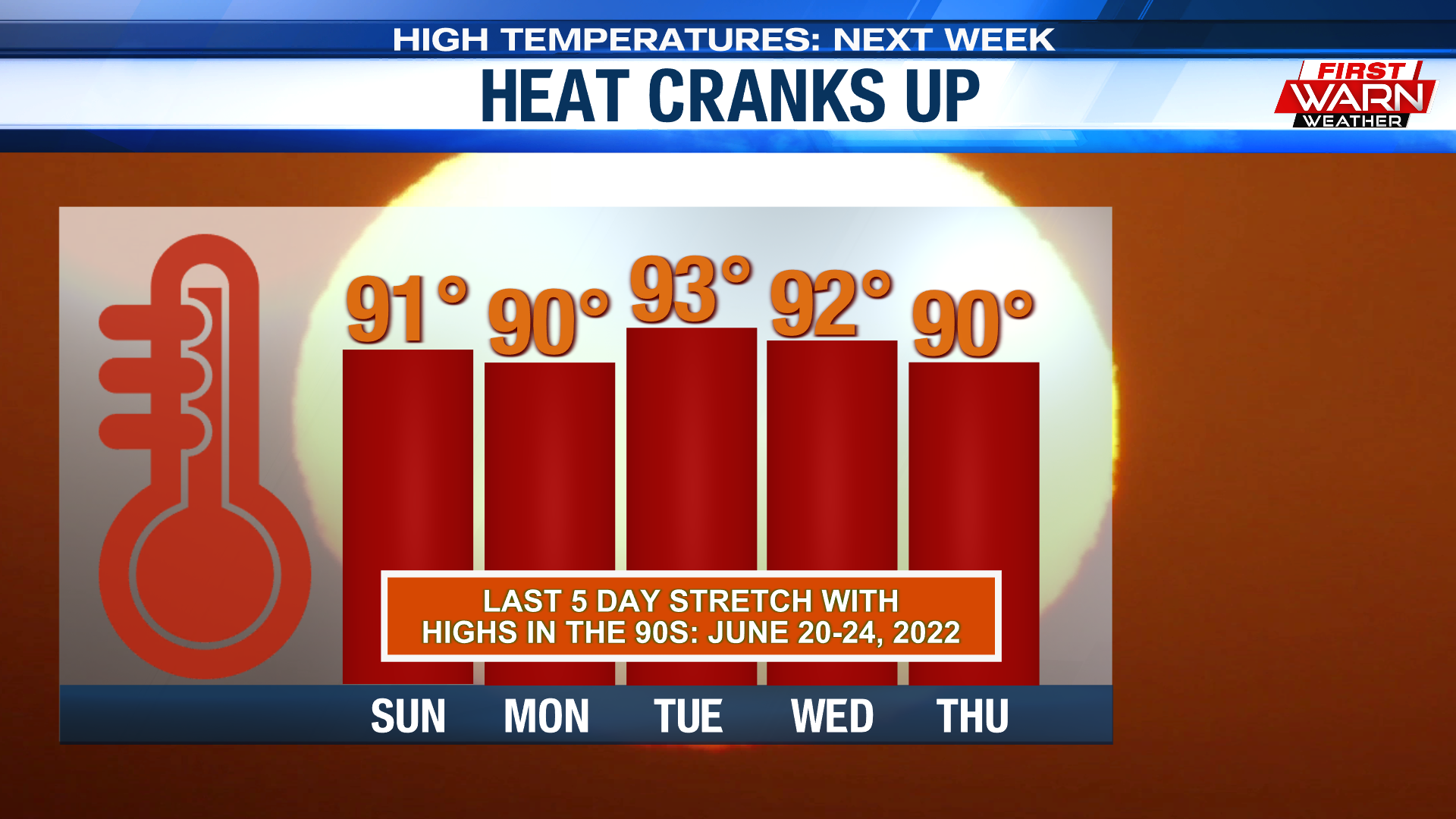
Thursday, August 31, 2023

Hot, but not overly humid, Labor Day weekend


Sunny skies greeted us on the last day of August as temperatures warmed into the mid and upper 70s. It has been an absolutely beautiful late summer afternoon. It would be even better if we had some rain in the forecast, but that chance remains extremely low through the holiday weekend and early next week.

Under clear skies Thursday night temperatures will dip back into the low 50s, climbing into the low 80s Friday afternoon. Winds will remain from the southeast throughout the day before shifting to the southwest Friday night.


A strong ridge of high pressure currently centered over the Plains will inch closer to the Great Lakes this weekend. Surface high pressure over the southeast will help keep the jet stream to the north. As a result, temperatures will warm near 90 degrees Saturday, then into the low to mid 90s Sunday and Monday. The 90-degree heat will continue early next week, with the 80s likely sticking around through the end of the week.


Even though temperatures are expected to warm the humidity will not be nearly as bad as it was last week. This has to do with the dew point temperature. Dew points last week warmed into the low 80s in a few locations. That is a VERY tropical-like air mass. Dew point temperatures going into the weekend will be nearly 20-30 degrees cooler than last week. This means that the heat index for the weekend will feel more like the actual air temperature, if not slightly below. A southerly breeze will also help offset some of the heat.

Early next week, however, Gulf moisture will slowly be on the increase causing dew point temperatures to rise slightly. As a result, it'll begin to feel a little more humid during the first full week of September.  

Wednesday, August 30, 2023

Fall-like feel Wednesday afternoon


Temperatures Wednesday afternoon warmed into the low to mid 70s making it feel more like mid to late September, rather than the end of August. While not terribly chilly, it may have felt a little more fall-like for some - especially during the morning.

High pressure moving in from Wisconsin will settle over Michigan later tonight setting the stage for a rather chilly night. Overnight lows will dip into the mid and upper 40s. Thursday will feature plenty of sunshine as highs warm into the upper 70s.


We will continue with the stretch of comfortable nights as dew point temperatures remain low. This means overnight low temperatures the next few nights will fall into the 50s, as afternoon highs warm through the 80s for the start of the weekend.

Drier air across the Great Lakes will keep a lot of the gulf moisture well to the south. High pressure moving into the Southeast late this weekend will turn winds slightly more to the southwest. The end result will be for dew point temperatures to climb slightly, reaching the upper 60s as early as next Monday. 


Temperatures will warm through the holiday weekend with highs reaching the low to mid 90s. Dew point temperatures remain low, upper 50s and low 60s, so heat index readings will feel more like the actual air temperature, if not slightly below. The humidity will begin to increase as winds turn more to the southwest early next week. Dry conditions remain straight through the weekend with the next chance for rain not returning until possibly next Wednesday.   

Perfect viewing for the second full moon of the month


Just as the sun sets to the west this evening, the full moon will be rising to the east. Sunset tonight is 7:34pm and moonrise is 7:48pm.

This full moon, known as a blue moon, is the second full moon during the month of August (also why it's called a blue moon). It's also known as a supermoon because it is closest to earth in its orbit, known as the perigee. This gives the illusion that the moon is bigger and brighter, but it still remains roughly 226,000 miles away from earth.

Conditions tonight will remain mostly clear as the sun sets. Temperatures at 7pm will be close to 70 degrees, falling into the upper 50s and low 60s around 10pm. So, if you do plan on being out after sunset, a light jacket may be needed.

Tuesday, August 29, 2023

Sunshine prevails throughout the week


Skies were quick to turn partly cloudy Tuesday afternoon following a weak surface trough (elongated area of low pressure) that moved through earlier in the day. We did see a few very isolated showers, but most locations remained dry.

A cold front moving in Tuesday evening will clear skies leading to temperatures dipping into the low 50s overnight. Winds will also turn light, shifting around to the northeast. We get a little taste of Fall Wednesday as high temperatures top out in the mid-70s. Shifting winds to the south through the end of the week will bring a warm-up into the holiday weekend.


High pressure this week leaves us with plenty of dry, sinking air as sunshine dominates our skies throughout the week. In fact, this could be one of the sunniest stretches of weather we've experienced this summer season. Temperatures will gradually warm, reaching back into the low to mid 80s by Friday. 


Upper 80s/low 90s are in the forecast for Saturday with the low to mid 90s beginning Sunday and lasting into at least early next week. This means a rather warm Labor Day weekend.


Monday, August 28, 2023

Isolated thunder chances return Tuesday


Temperatures were very comfortable Monday afternoon warming into the upper 70s and low 80s. With partly cloudy skies expected through the evening temperatures will hold in the 70s before falling around 60 degrees overnight.

Skies will turn clear tonight, but cloud cover moves back in by daybreak Tuesday ahead of a cold front. As the front moves through an isolated shower and thunderstorm remain possible, especially late morning and early afternoon. Coverage is expected to remain isolated, only around 20%, with some locations remaining dry. Storms may become a little more widespread during the afternoon, but that appears to be once they've moved out of the area.


There is a small chance for a strong wind gust or two with the favored locations being southern DeKalb Couty and southeast Lee County. Winds will increase behind the front from the northwest, gusting 20-25 mph. Highs on Tuesday will warm into the low 80s and then fall into the low 50s Tuesday night.

Pleasant weather sticks around, 90s on the horizon

Comfortable Start:

Quite the difference when you compare the temps we're waking up to this morning to last Thursday. If you recall, temperatures only sank down to 78°, which was Rockford's warmest low temperature recorded this late in the summer season. Thanks to a couple of cold fronts, temperatures this morning are sitting roughly 25° cooler in the low 50s.

Sunshine is expected to dominate our skies for much of the upcoming work week, including today where the sun will shine from start to finish. With our next cold front positioned to our northwest, winds today will be out of the southwest. 

This will allow highs to climb a few degrees warmer than Sunday, with most topping out in the low 80s. Despite the temperature climb, dew points will be sitting comfortably in the low 50s. 

Meaning, humidity will not be an issue at all today. Forecast models bring in said cold front Tuesday afternoon. With it does come a chance for an isolated shower or thunderstorm as well as a wind change to the north and northeast. This will help bring temperatures back down into the mid to upper 70s for Wednesday.

Heat Builds Back Up:

Remember the crippling heat we had last week? Well, it unfortunately looks to sneak back into the forecast for Labor Day Weekend. The combination of a warm front and a strengthening high pressure system aloft will allow the heat to quickly return. Southwesterly flow returns Friday, allowing highs to climb back into the upper 80s. Saturday, Sunday, and even into early next week is when the potential for highs in the 90s will be present. This would run 10° to 15° above early-September standards as we're normally dropping into the upper 70s.

Sunday, August 27, 2023

Summer heat set to return Labor Day weekend


Temperatures Sunday afternoon were very comfortable with highs warming into the middle to upper 70s. Rockford's high temperature reached 77 degrees, four degrees below the average. Under clear skies Sunday night, temperatures will dip into the low 50s. A little patchy ground fog may also be possible.

With the return of a southwest breeze Monday highs will warm back into the low 80s and remain in the low 80s Tuesday. A cold front moving through Tuesday afternoon will produce a very small chance for an isolated shower or storm but help to bring temperatures back into the 70s for Wednesday.


Following Wednesday, a strong warm front will lift through the region warming high temperatures by the end of the week and weekend back into the upper 80s and low 90s. In fact, we may be looking at several days of well above average temperatures for the beginning of September.

Right now, the high temperature for Friday, Saturday, and Sunday is in the upper 80s with temperatures reaching the low 90s for Labor Day. The good news, if there is any, is that dew point temperatures appear to be below what they were last week meaning heat index values shouldn't be too far from what the actual air temperature is.

While the temperatures will be going up, our precipitation changes may be going down. Long range outlooks place a higher probability for below average temperatures across much of the country, the Stateline included. This will likely cause our current drought conditions in Illinois and Wisconsin to worsen a bit as we look closer to Fall.

Thursday, August 24, 2023

Isolated severe storms possible Thursday evening


A SEVERE THUNDERSTORM WATCH has just been issued for Boone and McHenry counties in northern Illinois, and for Green, Rock, and Walworth counties in Wisconsin until 10pm. Thunderstorms have started to rapidly develop in Wisconsin along a lake breeze moving through Milwaukee and a cold front just north of Madison.


The storms near Milwaukee will continue to move southeast, over Lake Michigan, but the storms located near Madison, WI could impact parts of the viewing area within the next hour or two.

The current storm motion is to the southeast, placing areas along and east of I-39 having the best chance for isolated severe thunderstorms. Damaging wind gusts and torrential downpours will be the biggest threats with any severe storm that develops. Small hail may also occur.


Our window for thunderstorms will take us through 10pm, with drier skies expected overnight. it'll still remain humid through Friday with temperatures back into the upper 80s and the heat index in the low 90s.

Dangerous heat continues, few storms possible late

Wednesday's Heat:

Wednesday was the hottest day of the year and then some. Temperatures across the Stateline warmed into the mid to upper 90s, officially reaching 97° at the Rockford Airport. Heat indices during the afternoon came in even hotter, rising well over 110°

In fact, Rockford's max heat index was 117°. A glance at the record books shows that this is the third highest heat index since records began in 1951. The last time we had a heat index over 110° was July of last year when we reached 113°. The last time it was higher than that, July 13th, 1995. 

Dangerous Heat Continues:

The excessive heat warning continues, lasting until 8PM this evening. Expect high temperatures to surge into the upper 90s once again, with heat indices registering at or above 110°.  

Again, use the same precautions that you did yesterday to keep yourselves and your loved ones safe from the excessive heat. Be sure to drink plenty of fluids and limiting caffeine and alcohol intake. If outside, take frequent breaks in the shade or try to find a place that has air conditioning. Check on loved ones, elderly, children, and especially those without air conditioning. Also do not leave children or pets in unattended vehicles.  

Storm Chances:

As we've hinted at, our next cold front will not only help turn the heat down, but will also bring a chance for a few late-day storms. Overnight, the Storm Prediction Center expanded the level 1 Marginal Risk westward to include more of the region. This would be for the late-afternoon and early-evening time frame. Forecast models primarily keep the better chance for storms to our east. 

 But if any thunderstorm were to pose a threat for severe weather locally, gusty straight-line winds would be the primary concern. Chances come to a close early in the night, leaving us under a partly cloudy sky into Friday morning. Temperatures won't cool much, dropping into the low 70s. Highs on Friday will still manage to climb into the mid 80s before cooling towards the 80° mark for Saturday and Sunday. 

Wednesday, August 23, 2023

Heat stress increases with warm and muggy overnight lows


Temperatures Wednesday afternoon warmed into the middle and upper 90s, reaching 97 degrees in Rockford. This is our hottest temperature so far this summer season. Heat index values were even hotter, rising well over 110 degrees. The highest heat index recorded in Rockford was 117 degrees. The last time we had a heat index over 110 degrees was July of last year when we reached 113 degrees. The last time it was higher than that, July 13th, 1995! So, for some, this afternoon has been the hottest they've felt in their lifetime.

During times of extreme heat many look for relief at night when, typically, temperatures cool. But the next couple of nights there will be little relief with the overnight low temperatures as we remain in the upper 70s tonight, and then low 70s Thursday night.


Lows Wednesday morning only fell to the mid-70s and are expected to remain very closer to 80 degrees Wednesday night/Thursday morning. It is likely we remain in the low 70s Thursday night - with a warm day expected Friday. Shifting winds to the northeast Friday night will make it feel much more comfortable going into the weekend.

Excessive heat warning Wednesday & Thursday

Excessively Hot Wednesday:

Tuesday was the beginning of what's to be the hottest stretch of the year thus far. For most, temperatures peaked in the upper 80s. But when you factor in dew points in the low to mid 70s, heat indices ranged from the 95° to as high as 105°. 

As expected, the National Weather Service has upgraded all of our counties from an Excessive Heat Watch to an Excessive Heat Warning. This will run from 11AM this morning to 8PM Thursday as it's looking increasingly likely that heat indices are to reach between 105° and 115° both days. Sunshine is to dominate each of the next two days, with winds primarily blowing out of the southwest. Overnight lows tonight will be more of the same from this morning, with most falling into the upper 70s.

Timing of Front is Key:

Thunderstorm chances today will be very limited today due to a decent cap in the atmosphere. But as we've hinted at the past few days, the timing of our next frontal passage could hinder our full heating potential Thursday afternoon. If we see this front push this far inland, we could see the chance for a few isolated showers and thunderstorms. This would mean that heat indices won't be as intense. If not, however, then we remain excessively hot, humid, and dry. With Thursday's low chance for storms does comes a low risk for severe weather. 

The Storm Prediction Center placed a sliver of Winnebago and Dekalb Counties, along with all of Boone, McHenry, and Walworth Counties under a level 1 Marginal Risk for severe weather. If we do manage to see any thunderstorm become severe, gusty winds will be the primary concern. We won't see much cooling after the cold front comes through early Friday. Expect highs Friday to land in the upper 80s. It won't be until the weekend where we see a cooling trend in our temperatures.

Prioritize Heat Safety:

With it being excessively hot and humid these next few days, remember to take the necessary precautions to stay safe during the prolonged heat. If you can, avoid being outdoors. But if you can't do that, remember to prioritize heat safety. 

You can beat the excessive heat by wearing light colored clothing, taking frequent breaks in the shade and air conditioning, and of course remaining hydrated. Heat exhaustion and stroke can occur rather quickly if outdoors for too long. Several days of high heat and humidity, with little relief at night, can put added stress on your body. It’s important to know the signs of heat related illness and take the necessary steps to relieve those or seek medical attention if necessary.

While this hot, humid air can be uncomfortable to us, we also need to keep in mind how it affects our four-legged friends. Because remember, pets ARE family as well. I put this out there every time we correlate pets and the excessive heat. To ensure the safety of your pets, make sure they have plenty of water to keep them hydrated.

When it's time for them to use the restroom, keep their walks short and keep their paws off of the hot pavement. When the the air temperature reaches 90°, concrete temperatures soar to 135° to 145°, even hotter once air temperature reaches 95°. It’s far safer to walk them on grassy surfaces, preferably those where there’s shade.

Tuesday, August 22, 2023

Heat advisory Tuesday, excessive heat warning Wednesday

Hot Tuesday Ahead:

Monday was a rather beautiful day across northern Illinois and southern Wisconsin. Following an early morning cold front, highs for some landed in the low 80s. Areas closer to the Mississippi River came in a few degrees warmer in the upper 80s. 

Unfortunately, yesterday's comfortable weather won't be sticking around for our Tuesday as the high heat and humidity makes a quick comeback. A warm front positioned to our south will begin to lift north and northeast as our Tuesday progresses. This will allow temperatures to climb, reaching the upper 80s and low 90s during the afternoon. Along with the rise in temperatures will also be the rise in moisture levels, pushing the heat index into the low 100s in some locations. 

For that, a HEAT ADVISORY will be in place for Winnebago, Ogle, and Lee Counties in northern Illinois as well as Green, and Rock Counties up in southern Wisconsin from 11AM to 9PM. 

Areas to the west that have a better shot at seeing heat indices at or above 110-degrees have been put under an EXCESSIVE HEAT WARNING. Temperatures will stay seasonably warm overnight, falling into the low 70s by sunrise Wednesday.

Hotter Wednesday:

Wednesday looks to be even hotter as the warm front will be positioned to the north of the area. This will result in a wind shift to the west-southwest, allowing temperatures to surge into the upper 90s. Combine that with dew points in the upper 70s and you get heat index values ranging from 110-115 degrees. For that, the National Weather Service has placed all of our counties under an EXCESSIVE HEAT WARNING. This will be in effect from 11AM to 9PM. 

Thursday's Heat:

Thursday could be just as hot. However, there are a few things we'll have to keep an eye on that may limit our full heating potential. A lake-enhanced cold front may be strong enough to spark up a few isolated showers and thunderstorms. 

If we don't see any of this activity make it's way this far inland and we end up staying dry during the afternoon, then expect highs to soar back into the upper 90s. At this moment, Ogle, Lee, Winnebago, Boone, McHenry, and Dekalb Counties as well as our three counties up in southern Wisconsin remain under an EXCESSIVE HEAT WATCH. Once there is more clarity into Thursday's potential for rain, we will have a better idea on how hot and humid it will be. 

Heat Safety:

With it being excessively hot and humid the next few days, remember to take the necessary precautions to stay safe during the prolonged heat. If you can, avoid being outdoors. But if you can't do that, remember to make heat safety a HUGE priority. 

You can beat the excessive heat by wearing light colored clothing, taking frequent breaks in the shade and air conditioning, and of course remaining hydrated. Heat exhaustion and stroke can occur rather quickly if outdoors for too long. Several days of high heat and humidity, with little relief at night, can put added stress on your body. It’s important to know the signs of heat related illness and take the necessary steps to relieve those or seek medical attention if necessary. 

Monday, August 21, 2023

Temperatures begin their climb Tuesday

 
Temperatures Monday afternoon were a little more typical for what we feel mid-August with highs reaching the mid-80s. We'll see a little more haze during the evening and overnight, filtering out some of the moonshine, as overnight lows dip into the low 60s.

A strong warm front centered across the Plains will begin to lift north and northeast during the day Tuesday. This will allow temperatures to climb, reaching the upper 80s and low 90s during the afternoon. Allow with the rise in temperatures will also be the rise in moisture, pushing the heat index into the low 100s in some locations. Heat index temperatures are likely to range between 95-105 degrees.

By Wednesday the warm front should be to our north, turning winds to the southwest and cranking up the heat. Highs on Wednesday are forecast to reach the mid-90s, but with dew points warming into the upper 70s heat index values are likely to reach as high as 110-115 degrees.


A HEAT ADVISORY goes into effect for: Winnebago, Ogle, Lee, DeKalb, Boone, Green, and Rock counties lasting through Tuesday night. An EXCESSIVE HEAT WATCH will then go into effect Wednesday morning.

An EXCESSIVE HEAT WARNING goes into effect for Stephenson, Jo Daviess, Carroll, and Whiteside counties and will run through Wednesday night, with an EXCESSIVE HEAT WATCH going into effect through Thursday.


There does remain a very small chance for an isolated storm or two, especially Thursday, as a cold front sweeps down Lake Michigan. If we see that push this far inland, it'll temper some of the heat for the afternoon. If not, however, then we remain very hot, humid, and dry. Little relief will occur at night with overnight lows beginning Tuesday night only falling into the 70s. The combination of the hot and humid days and very warm nights - typically when we look for relief from the heat - will take an added toll on our bodies during this heat wave, especially those who are more vulnerable to heat-related illnesses. Here are the symptoms of heat exhaustion and heat stroke.


Brief break from the heat today, heat advisory Tuesday

Not As Humid:

Sunday's heat was similar to what we've experienced eight other days since the start of June. Officially, the Rockford International Airport came in with a high of 91°, with a max heat index of 103°.   

Fortunately, a frontal boundary sliding through early in the day will bring short-lived relief for the start of the work week. Winds behind this front will blow out of the east-northeast, leaving highs in the upper 80s this afternoon under partly cloudy skies. At their highest, heat index values will climb into the low 90s. Skies remain partly cloudy overnight, with temperatures falling into the low 60s which is considered seasonably.

Heat Advisory Tuesday:

From there, a lifting warm front will help shift our winds back to the south/southwest Tuesday. This will allow a major warm up to occur, resulting in highs in the low 90s for the tenth time this year. Combine our high temperatures will dew points in the mid to upper 70s, and you got heat indices at or above 100°. For this reason, the National Weather Service has placed us under a HEAT ADVISORY from 11AM to 9PM. Our counties to the west however could see heat indices at or above 115-degrees, hence why these areas are under an EXCESSIVE HEAT WARNING. 

Excessive Heat Watch:

The worst of the heat and humidity arrive Wednesday into Thursday. With a warm front positioned to our north, southwest winds at both the surface and the low-levels will help push temperatures into the upper 90s both days. Once you add the humidity into the mix, heat indices could be as high as 110° to 115°. For that, they have placed the entire region under an EXCESSIVE HEAT WATCH from Wednesday morning into Thursday evening.

Heat Safety:

Given the likelihood of several 90° (plus) days and heat index values over 100°, it’s very important to make sure you’re taking the necessary precautions to stay safe during the prolonged heat. If you can, avoid being outdoors. But if you can't do that, remember to make heat safety a HUGE priority. 

You can beat the excessive heat by wearing light colored clothing, taking frequent breaks in the shade, and of course remaining hydrated. Heat exhaustion and stroke can occur rather quickly if outdoors for too long. Several days of high heat and humidity, with little relief at night, can put added stress on your body. It’s important to know the signs of heat related illness and take the necessary steps to relieve those or seek medical attention if necessary.

Friday, August 18, 2023

Hazy skies return, 90-degree stretch begins Sunday

Hazy Friday:

Mother nature gave us another beautiful August afternoon Thursday. Sunshine dominated our skies from start to finish, with highs peaking in the upper 70s for the third straight day!

Friday features more of the same. But as we hinted at in yesterday's discussion, we have another plume of thick smoke tracking into the Great Lakes. Some of that smoke unfortunately may reach ground level, making air quality difficult for some. 

According to AirNow.Gov, air quality levels across the region will be considered unhealthy for sensitive groups, such as young children, older folks, and those with heat and lung issues. To be safe, partake in less strenuous activities or shorten the amount of time you are active outside. Skies will turn partly cloudy as we head into tonight, with temperatures falling into the upper 50s.

Weekend Warmth:

Forecast models show a high pressure system sliding to our southeast Saturday morning. This will not only keep our weather pattern dry for Saturday and for most of Sunday, but it will also result in a spike in temperatures. Expect highs to peak in the upper 80s, with low 90s slated for Sunday afternoon. In fact, Sunday is when we begin a stretch of hot weather that aims to carry on well into next week.

Heat Cranks Up:

It's during this time in which we see a strong heat dome of high pressure set up over the central portions of the country. Underneath this heat dome will be an air-mass that will likely leave high temperatures in the 90s well into next week. 

As of this morning, we have highs in the low 90s from Sunday through Thursday. The last time the Rockford Airport observed 5 straight 90-degree days was June 20th-24th, 2022. Of course, the rise in heat will be accompanied by a rise in humidity, so expect heat indices to approach or even eclipse the 100-degree each of these 5 days. Additionally, this strong ridge will help to keep rain chances away. There is a chance for a few showers Sunday night into Monday, but even those chances are slim.