

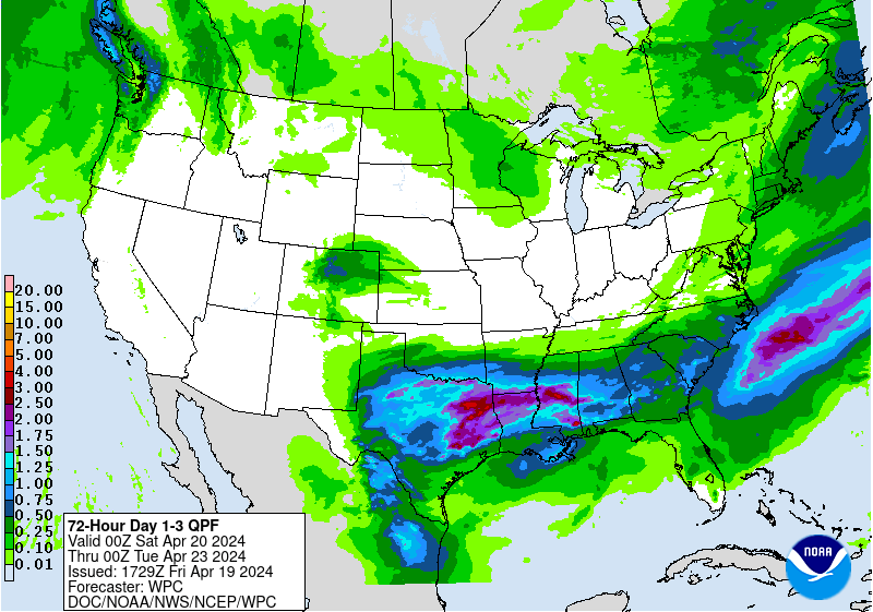
With any thunderstorms that develop, the risk of heavier downpours will always be present. However, the heaviest rainfall associated with this next storm system will fall north of the low

pressure system's track. This places the heaviest rain corridor over Wisconsin, Minnesota and northern Iowa. There, a couple inches of rain could occur between now and the end of Thursday. The second image on the left is from the Weather Prediction Center three day rainfall outlook.
Following the passage of the low Thursday night, skies will remain cloudy with scattered showers and isolated thunderstorms into the weekend.
No comments:
Post a Comment