

Mother nature brought her own fireworks for the 4th of July as multiple rounds of thunderstorms tracked through the Stateline.
All of which brought an elongated threat for severe weather and the potential for flash flooding. Now, with us still under this "ring of fire" weather pattern, the threat for severe weather returns later today. However, it'll be today's excessive heat and humidity that becomes the bigger headline.

A HEAT ADVISORY will be in effect for the entire region from mid-day till 8PM.
During this time, highs temperatures will be peaking in the low to mid 90s. That, along with dew point temperatures in the low to mid 70s will allow heat indices to either touch or eclipse the triple-digit mark.
If you can, limit time outdoors today. If that option is off the table, please be sure to have plenty of water on hand and take frequent breaks in the shade. Today's heat and humidity will be one of the big reasons why a few storms will be possible later in the day. And yes, severe weather is also on the table.
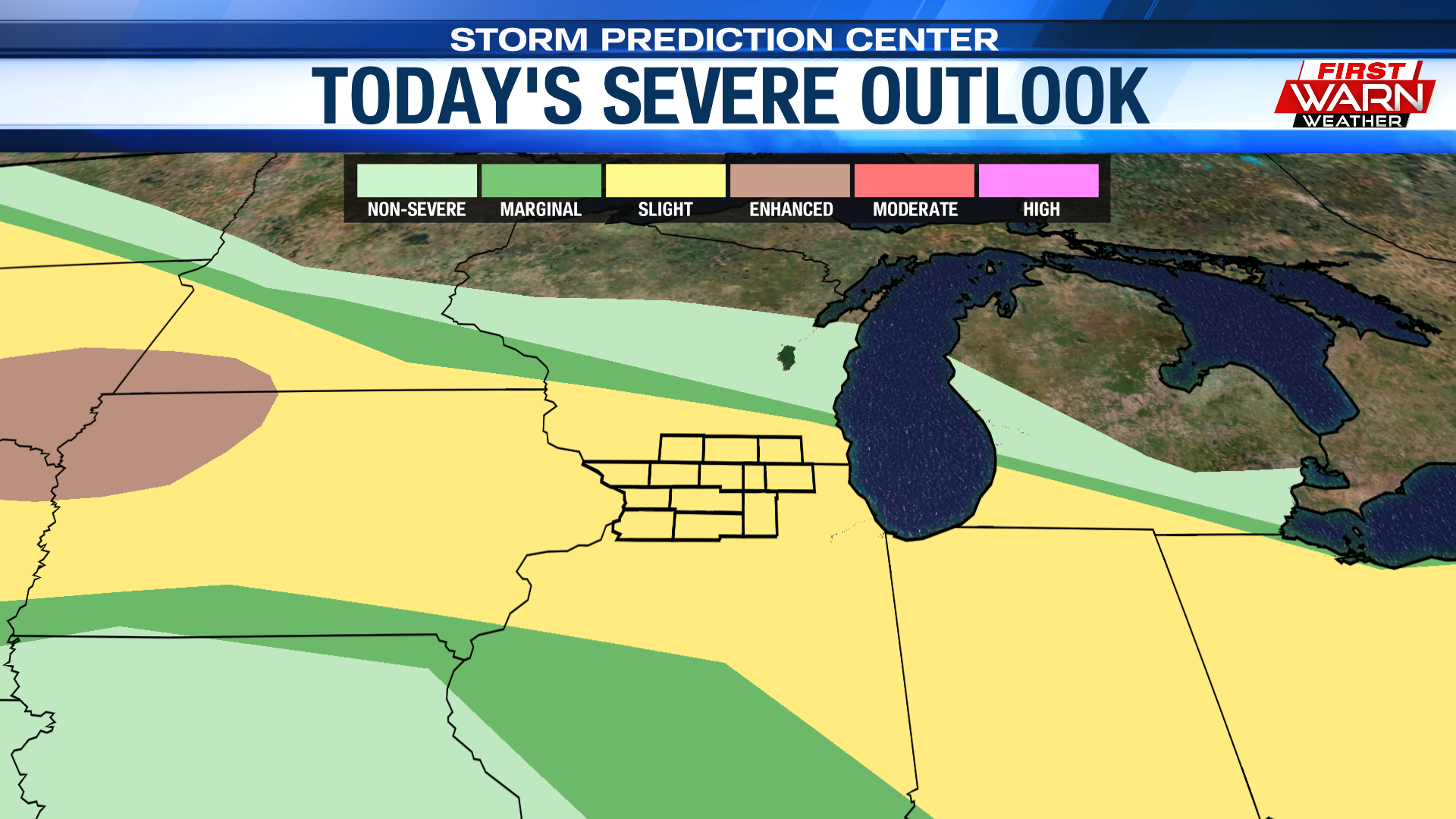
Similar to Independence Day, the entire Stateline has been placed under a Slight Risk (level 2 of 5) for severe weather. This is for the round of thunderstorms that look to form along a westward-moving lake breeze boundary late Tuesday.
For any storm that showcases severe characteristics, damaging winds and hail will be the biggest concerns.

And of course, with the vast amount of moisture in our atmosphere, heavy rainfall and flash flooding will also be a big concern. Guidance continues to keep a chance for scattered showers and thunderstorms overnight, with a frontal boundary sinking to our south by early Wednesday morning. The northeast flow behind the front will help cool our high temperatures back down into the 80s for the remainder of the work week.
No comments:
Post a Comment