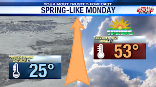
In my opinion, mother nature brought the right dose of weather to ring in Astronomical Spring. To recap, Rockford registered a high of 53° under a mix of clouds and sun. A significant improvement as the Stateline was sitting in the bitterly cold 20s just two days prior. Looking ahead, we do have a few more days with highs in the 50s. However, the closer and closer we get to the weekend, the more active our weather pattern will get.
Few Showers Late:
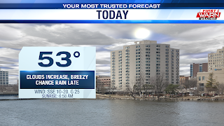
The best chance for sun today will during the early portions of the morning. As we inch closer to the mid-day hours, the Stateline will once again be sitting under a mostly cloudy sky. Despite today's cloud cover, the low to mid 30s that we wake up to will provide a warm enough start for temperatures to peak in low 50s this afternoon.
 It also helps that our winds will be blowing out of a south and southeast during peak heating hours (11AM-4PM). In a similar fashion to Monday, a sprinkle or two can’t be entirely ruled out. But most of the day should remain dry.
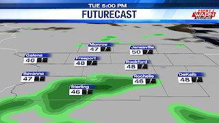
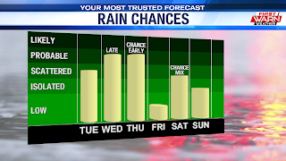
Towards the end of the evening commute, a round of scattered showers will develop, with chances likely lasting into the first half of the night. As the low responsible for these showers pulls away, conditions will dry out but remain mostly cloudy into Wednesday. Temperatures will end up slightly warmer, landing in the upper 30s.
Active Pattern Continues:
The best chance for rain moves in late in the afternoon Wednesday as a cold front approaches from the west and northwest. Once rain begins to fall, it will likely last into Wednesday night and even into the early portion of Thursday.
Forecast models then show this boundary stalling across central Illinois, placing the region under a chilly northeast regime. This will likely bring down our temperatures for the late-week days, with highs both Thursday and Friday peaking in the mid to upper 40s. Temperatures over the weekend will all depend on the track that a secondary storm system takes across the Midwest. Same with the type of precipitation we'll see, especially Friday night into Saturday.


No comments:
Post a Comment