

It's the day that many, including myself, look forward to the moment we switch into the winter season, the day of the Vernal Equinox!
To recap, this is the point in the Earth's trip around the sun where the center of the sun's rays are directly focused above the equator, bringing us roughly 12 hours of day and night.
Today's sunrise will be around 6:59AM, with the sunset happening at 7:08PM! While a majority of winter featured more above-average days than seasonable or below-average days, winter did give us a run for his money over the last two weeks. So much so that Rockford observed it's highest daily snowfall total for the season back on March 9th, picking up 6.8". Similar accumulations were observed to our north and west. We also saw a rather cold northwest wind restrict high temperatures to the mid 20s this past Saturday. But thankfully the wintry chill from this past weekend won't be sticking around as we make the seasonal change!

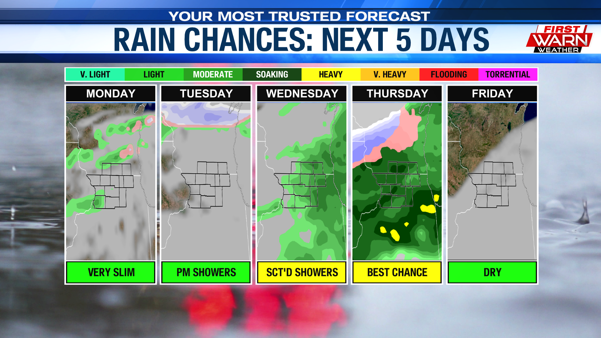
Monday kicks off with partial sunshine, with clouds increasing into the afternoon. This is all in response to a weak frontal boundary that parks itself to the north across SE. WI.
With the Stateline being located south of the front, winds will breezy but out of the southwest. Temperatures because of this will be able to climb to seasonable levels, with most landing in the upper 40s. Along with the cloud cover, a few sprinkles can’t be entirely ruled out Monday afternoon. The cloud cover and the chance for sprinkles lingers into the overnight hours, with temperatures falling into the low 30s. A secondary chance for scattered showers arrives Tuesday, with highs climbing into the low 50s.

During the Wednesday and Thursday time frame, forecast models show a big dip in the jet stream to the west of the Rockies. N. IL and S. WI will be placed on the eastern side of the dip or trough, right under the stronger wind flow.
At
the same time, a rather strong frontal boundary is shown sliding through the region, stalling out just to the south of Interstate 80.
Now, it should be known that the position of said boundary could change over the next 1-2 days. But depending on where that boundary ends up will determine if we trend upwards or downwards with our temperatures and also when and where the heaviest rain will fall. For now, we have temperatures climbing into the low 50s ahead of the frontal passage, then sinking back down into the upper 40s both Thursday and Friday.
No comments:
Post a Comment