

Scattered rain showers will continue to move across northern Illinois and southern Wisconsin Thursday evening, picking up a little in intensity between 6:30pm and 10pm. The rain will still remain light but become more widespread once the sun sets. Before the rain moves in, we may see a little fog develop.
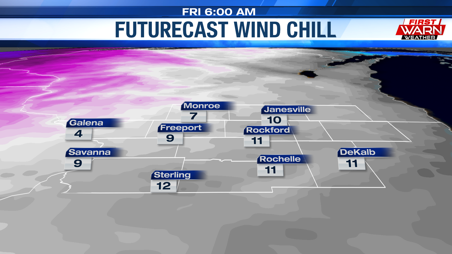
Temperatures will stay in the 40s Thursday evening ahead of a cold front currently moving through Iowa. As the front passes, temperatures will fall, dropping to the 20s by Friday morning. Wind chills Friday morning will fall into the low teens.

Strong northwest winds will also follow, at times gusting to 30-40 mph Friday morning. Winds will actually increase during the afternoon as low pressure deepens and moves over the Great Lakes. Winds will then remain around 30 mph throughout the afternoon and evening.
Unfortunately, it doesn't look like our wind speeds will ease going into Saturday. Saturday could be just as windy as Friday. It will be colder, however, with
No comments:
Post a Comment