Thursday, March 31, 2022

Flurries/light snow continue Thursday evening


For some Thursday morning it looked a little more like a winter wonderland as sticking snow came down across the Stateline, adding up to just over an inch in northern Illinois and southern Wisconsin.  Further south, steady snow also fell but didn't stick.

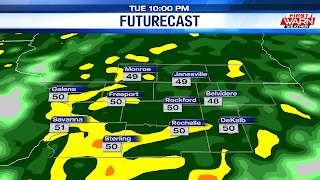
While the snow did lighten up for a time during the afternoon, another low shifting in from the north Thursday evening will keep the chance for flurries and light snow showers through much of the evening, with clearing skies expected by early Friday morning.  The snow coming down will remain mostly light, but a dusting on grassy and elevated surfaces, especially now with temperatures dipping closer to freezing, is possible.


Temperatures will remain steady in the low to mid 30s Thursday evening before dipping into the mid 20s Friday morning.  High pressure moving through the Midwest will give us more sunshine and slightly warmer temperatures Friday ahead of another fast moving storm system that'll bring the potential for another round of snow and rain late Friday night and Saturday morning.  Saturday morning's precipitation type will depend on the overall track of a tightly wound low pressure system.  A track north of the state line would give us a little more rain, while a track further south would give us a better chance for snow.  Snow totals could add up to another inch, mostly on grassy surfaces, during that time.


Temperatures will remain steady in the low to mid 30s Thursday evening before dipping into the mid 20s Friday morning. High pressure moving through the Midwest will give us more sunshine and slightly warmer temperatures Friday ahead of another fast moving storm system that'll bring the potential for another round of snow and rain late Friday night and Saturday morning. Saturday morning's precipitation type will depend on the overall track of the tightly wound low pressure system. A track north of the state line would give us a little more rain, while a track further south would give us a better chance for snow. Snow totals could add up to another inch, mostly on grassy surface, during that time. 

Minor SNOW Accumulations Possible This Morning, Sunshine Returns for Friday

Say It Ain't Snow?: 

Yesterday was the first above above-average day since the 23rd as highs across the Stateline peaked in the lower 60s. Unfortunately, Wednesday's taste of spring was very brief. A strong cold front sliding through overnight sent temperatures tumbling, landing in the mid 30s before sunrise. This has not only brought a much cooler start to our day, but it also has aided in the precipitation changeover.

Snow looks to be the primary type of precipitation for a few hours this morning, leading to minor accumulations. Current thinking suggests that much of northern Illinois will fall under the dusting to 2" range, with our areas up in southern Wisconsin landing in the 2"-3" range.

Accumulations will occur mainly be on grassy surfaces. Roadways aren’t likely to see major impacts, though some slush will be possible on some of the lesser traveled bridges and overpasses. As temperatures warm close to the 40-degree mark this afternoon, today's chances will end as a scattered rain/snow mix. As a ridge of high pressure takes control of our atmosphere, clearing will take place overnight into Friday morning. This will pave the way to a sun-filled day tomorrow. Temperatures, because of a light northwesterly wind, remain seasonably chilly in the upper 40s.

Few Systems To Watch:

Following Friday's sunshine, another weak storm system looks to aim it's sights on the Stateline during the first half of the weekend. The track of this system will keep temperatures cool, with highs peaking in the low to mid 40s. This will allow for a chance light snow at first, mixing with rain showers as we head into the afternoon. We should dry out by Saturday evening, with dry conditions lasting well into Sunday. 

Wednesday, March 30, 2022

Wet Wednesday Ahead, Snow Mixes in By Thursday Morning

Wet Wednesday:

So, there's good news and bad news when it comes to today's forecast. Which shall I start with? Okay, let's start with the good news. 

The good news is that Wednesday does feature a very brief "break" from the recent stretch of cooler-than-average temps as highs look to land well-above average. However, today's warmth does come at a cost as a storm system gliding into the Midsection of the United States will bring the potential for several rounds of rain. 

Timing Out the Rain:

The more widespread and heavier activity is expected to pass through during the first half of the day. If you plan to head out at any point this morning, be sure to have an umbrella on hand. It's during this time when a few embedded thunderstorms will be possible. Again, severe weather is highly unlikely. 

Rain showers then look to continue into the afternoon hours, but more in a scattered fashion. With the warm front to sliding into southern Wisconsin, highs across the region will peak in the lower 60s. However, the associated cold front will be quick to follow, continuing the chance for scattered showers well into the evening. Temps behind this afternoon's cold frontal passage will tumble, landing in the mid 30s by Thursday morning. 

Say it Ain't Snow?:

On the backside of the surface low, a round of cooler air is expected to filter into the western Great Lakes from the Upper Midwest. This will help transition any precipitation around the area to a mix of rain and snow by sunrise. 

A few models were also favor the possibility for snow to be the primary precipitation type for a few hours. While it's safe to say we're not expected any chance for significant accumulations, a dusting will be possible on grassy surfaces. Temperatures tomorrow only look to peak in the low 40s. As a high pressure system takes control of our atmosphere, sunshine returns for Friday with highs back in the upper 40s. 50s return by Sunday and stick around into early next week.

Tuesday, March 29, 2022

Colder air settles in Thursday following heavy rainfall Wednesday

 
Temperatures will quickly rise through the night Tuesday, reaching the low to mid 60s Wednesday afternoon before crashing back down Thursday morning as a strong storm system continues to move across the center of the country Tuesday evening.

Cloud cover will remain in place Tuesday as moisture and warm air continue to surge in from the southwest.  The air mass down near the surface, however, is still pretty dry and this will limit any shower activity through early Tuesday evening.   As the atmosphere continues to saturate through the night, scattered rain showers are likely to develop after about 9pm/10pm, with heavier rain and elevated thunderstorms possible after Midnight.  Thunderstorms should remain non-severe, but heavy downpours and small hail are possible for some.


Ongoing severe weather across the Plains Tuesday evening will move east, but weaken as it does so outrunning some of the higher moisture and instability.  A warm front stretching from northern Missouri to southern Illinois will lift north Tuesday night, reaching northern Illinois Wednesday morning before lifting north into Wisconsin mid to late morning.

Scattered thunderstorms are likely throughout the


day Wednesday, with a few heavier downpours late morning, afternoon and evening.  A strong cold front moving across the area between 6pm and 9pm Wednesday evening will bring temperatures down from the 60s during the afternoon, into the 40s Thursday.  

Colder air wrapping in on the backside of the low could allow some light snow to mix in from time to time, with minor accumulations on elevated surfaces possible, especially during the morning.  Northwest winds gusting to around 40 mph will push wind chills down during the day, bringing overnight lows back into the 20s Thursday night.  Temperatures will remain on the cooler side through the end of the week, rising back near average (low 50s) by early next week.


Soaking Rain Chances Return, Thunderstorm Potential Wednesday

Rainfall Check-Up:

As we inch closer to the conclusion of March, we've seen quite the opportunities for some much-needed rainfall throughout the month. So far, the Rockford International Airport has accumulated 2.03" of rain since March 1st, landing near average. However, we still have another rain event or two before we erase the yearly rainfall deficit. Well, the good news is that one of those rain events is slated to begin late today, with the heaviest rain arriving Wednesday.

Few Showers Late:

Ahead of a lifting warm front, highs this afternoon will only reach the lower 40s under a mostly cloudy sky. However, it is because of this frontal boundary that our atmosphere sees a surge of moisture into Tuesday night, resulting in a chance for a few late-day showers. As moisture continues to increase overnight, rain will become more likely and widespread in nature. Lows briefly dip into the upper 30s early in the night before climbing into the mid to upper 40s by sunrise Wednesday.

Thunderstorms Wednesday:

Wednesday is looking more than likely the day where you'll need the rain gear. Guidance continues to keep the likelihood for widespread rain, along with the potential for a few isolated afternoon thunderstorms as the cold front enters the region. With that being said, severe weather is highly unlikely. Temperatures ahead of the surging cold front will peak in the lower 60s before tumbling into the upper 30s overnight. On the backside of the surface low, cooler air will filter in, allowing for a chance for mixed precipitation during the early stages of Thursday.

How Much Rainfall?

While it's safe to say that snowfall accumulations are unlikely across Northern Illinois and Southern Wisconsin, we do end up seeing a healthy amount of rainfall over the next 3 days. Forecast models this morning came in with precipitation totals between .75" to as high as 1.5". As I mentioned before, this would greatly help put a big dent or event eliminate our yearly rainfall deficit and also help out with the current drought situation. Conditions then look to dry out for Friday, with highs climbing back into mid 40s.

Severe Returns to the South:

Similar to last week, the deep south states will once again be the center or focal point for a significant severe weather event on Wednesday. Earlier this morning, The Storm Prediction Center placed portions of Louisiana, Arkansas, Mississippi and Alabama under a massive moderate risk (level 4 of 5) for severe weather. 

Storm mode for the most part looks to be linear, meaning the chance for discrete storms during this event is very low. However, this line of strong storms will bring the potential for damaging winds up to 75 mph and a few strong tornadoes (EF-2+). If you know anyone that live in these areas, please make sure that they are updated on the forecast as well as have their safe place ready to go.

Thursday, March 24, 2022

Rain and snow showers possible Friday


The last several days have been rather rainy, adding up to just under one inch of precipitation since Tuesday in Rockford.  Scattered light rain showers and drizzle will continue through the evening Thursday as low pressure slowly rotates away from the Stateline.  North winds have kept temperatures in the low 40s, well below the average high of 50 degrees.  As temperatures continue to cool through the evening, there may be a few snowflakes that mix in before Midnight.


There isn't much of a break between the departing low pressure system Thursday night and the next low slated to move in Friday afternoon.  West winds Friday will bring temperatures slightly closer to average, but highs are expected to remain in the mid 40s.  The day will likely start with some cloud cover before a little dry air works in around Noon.  This could bring some breaks in the clouds, and finally give us a little sunshine.  But the added sunshine could help build instability ahead of a rather strong cold front and low pressure system currently near the Canadian Rockies.  This low will quickly dive southeast through Minnesota and into southern Wisconsin and northern Illinois Friday evening, pulling a cold front through as it does so.


Scattered rain showers are likely to develop, some possibly more convective in nature with small graupel occurring with some of the heavier showers.  Winds will be strong from the west/northwest during the afternoon with gusts near 30 mph.  As the colder air arrives Friday evening, wind gusts to 40-45 mph may occur.

During the evening snow will be possible, driven by the strong cold front and upper level low.  Like the rain showers, these too could be convectively driven and develop into snow squalls that move across the region.  The best time frame for these snow squalls would be roughly between 6pm and 12am.


Snow squalls are nothing new, but aren't too common for us in the Stateline.  A couple months ago there were numerous 'snow squall warnings' that were issued on a Friday evening as heavy snow moved across the area.  This intense burst of snow reduced visibility quite a bit and caused road conditions to deteriorate for a time during the evening.  Snow squalls usually occur fairly quickly and are defined as an intense burst of snow and wind.  They can produce near whiteout conditions with a sharp drop in visibility, causing rapidly deteriorating road conditions.  Snow squalls do not last long and are usually out of the area within an hour or two.


Rain, Rain Will Not Go Away, Another Round of Showers Arrive Late Friday

Much-Needed Rain:

The Stateline has been given yet another opportunity at much-needed rainfall thanks to a slow-moving nature of a low pressure system. 

Over the past two days, the Rockford Airport has observed .98" of rain, placing our monthly total at 2.03". More moisture for spring and a counter to the moderate drought (D2) that much of northern Illinois and southern Wisconsin remain under this morning. As for our rain chances moving forward, the light at the end of the tunnel can be seen. We just have to get through what's left of this slow-moving low today and then another quick chance for shower Friday. Then, we'll see a nice break from this active and wet pattern for the upcoming weekend. 

Lingering Showers:

A frontal boundary sliding through Wednesday afternoon will result in a cooler day today, with highs hovering around the 40-degree mark. To compare, that's 10° to 20° cooler than highs both on Tuesday and on Wednesday. 

While much of what falls with our scattered chances today will be rain, the cooler air may allow for a few slushy snowflakes to mix in. Especially later on in the day. Because of the recent warm spell, road temperatures will be warm enough to avoid that potential for accumulations and slick spots. However, a dusting may be possible on grassy surfaces. A shower or two remains possible during the evening before we completely dry out to a mostly cloudy sky for the overnight hours.Temperatures look to drop into the mid 30s by Friday morning. 

Friday's Chances:

A separate disturbance sliding in from the Upper Midwest will bring another shot at some rain by Friday afternoon. For the most part, rain will be the primary type of precipitation. However, once the strong cold front slides through, the possibility for a few mixed snowflakes is not out of the question. 

This cold front will help filter in a much cooler air-mass into the western Great Lakes overnight Friday into Saturday, leaving temperatures chilly for the weekend. Highs Friday look to just hit the 50° mark, then tumble down into the low 40s for both Saturday and Sunday. Even though the weekend will be a chilly one, sunshine is expected to return giving us a nice break from this rainy weather pattern. 

Wednesday, March 23, 2022

Funnel clouds possible early Wednesday evening


Cold air funnels are possible across Ogle, Lee and DeKalb counties through early Wednesday evening as both an upper level low and surface low move through northern Illinois.  A couple funnel clouds were spotted northeast of Steward in Lee County around 6pm.

Severe weather is not expected this evening as these types of funnels only come down a few hundred feet from their parent cloud, spin like a top for a few minutes before dissipating.  On a very rare occasion the funnel cloud may reach the ground, and if so, you should seek shelter.  The instability in the atmosphere will weaken after sunset, but the scattered showers will continue through the night.


Another Gloomy Day Ahead, Temps Cool into Thursday

Healthy Rainfall:

Another round of healthy rain made it's way into the Stateline overnight, dumping between .5" to 1" across much of the area. 

This bringing much-needed aid to the current drought situation in northern Illinois and southern Wisconsin as the ground is in a state where it can absorb the recent rainfall. I wouldn't put your umbrella away just yet. The approach of this storm system will keep the chance for rain shower not only for our Wednesday, but into our Thursday as well.

Rainy, Gloomy Wednesday:

Similar to Tuesday, the dry hours will outweigh the wet hours. However, there is the possibility at any point during the day for a couple of showers, with the showers remaining scattered in nature. Not steady and widespread like the rainfall we encountered during Tuesday night. 

Ahead of a cold front, temperatures this afternoon will peak in the low to mid 50s, with surface flow changing to the west-northwest into tonight. The cooler air that filters in may bring the chance for a few snowflakes to mix in before chances wind down on Thursday. The passage of this cold front will also spell the end of our 11-day above-average streak as highs Thursday afternoon will only peak in the low 40s. 

Conditions Quiet Down:

In addition to what we received last night, models show another .10"-.25" of rain falling over the next 24 hours. A separate disturbance diving into the Upper Midwest/Great Lakes Friday may bring a few showers to the area during the afternoon. Other than that, our weather pattern turns more quiet for the upcoming weekend. Highs briefly touch the 50s on Friday before cooling into the low to mid 40s for Saturday and Sunday.

Tuesday, March 22, 2022

Heavier rain moves back in Tuesday night


Following a break in the rain Tuesday afternoon, showers have moved back in Tuesday evening and will grow in both coverage and intensity as a warm front and low pressure system move closer to northern Illinois.  Temperatures have remained well below Monday's high of 75 degrees, sitting in the low to mid 50s for much of the afternoon.  While still above average the cloud cover, rain and gusty east wind have definitely put a damp chill back into the air.


The rainfall from Tuesday morning wasn't much with most areas receiving under a quarter of an inch.  Additional rainfall through Tuesday night, Wednesday and Thursday will add up between half an inch to three quarters of an inch.

Instability increases slightly overnight Tuesday into Wednesday morning as the low arrives into northern Illinois.  This may allow a few thunderstorms to develop during that time, briefly increasing the


rainfall rates.  Flooding is not a concern as most of the heavier rainfall will be progressive through that time.  Scattered rain showers will continue through Wednesday afternoon and evening, before tapering off Wednesday night.  Colder air wrapping in Thursday morning may allow a few snowflakes to mix in with the rain showers during that time.


Wetter, Cooler Weather Pattern Slides in Following the Warmest Day of 2022

Warmest Day of 2022:

Sunny and 75... Yes, that is the title of a very popular Kenny Chesney song. But that phrase also describes the beautiful weather the Stateline endured on the first FULL day of spring. 

While yesterday's high lands well above the average high of 49°, it still wasn't record warmth as the peak of the March 2012 heat wave occurred on the 21st (84°). But being only 9-degrees away from tying the record high should give you a pretty good indication on how warm it was yesterday. Unfortunately, our weather pattern takes a big turn as we look to trade in yesterday's sunshine and warmth for long-lasting rain chances.

Rain Chances Return:

A storm system sliding into the Midwestern section of the U.S has allowed moisture to increase locally. This has result in cloudy skies and the chance for light rain showers as you prepare for your day. 

The rain will be steady through the morning hours before becoming more scattered during the afternoon. Before heading out, make sure to have an umbrella with you. Winds will primarily be out of the southeast, gusting to 30 mph at times. This will result in MUCH cooler day overall with temperatures rising into the low to mid 50s. As this area of low pressure moves closer to the Stateline, rain will pick up in intensity Tuesday evening and Tuesday night.

Guidance does show the possibility for a few rumbles of thunder. With that being said, severe weather is likely out of the question. Scattered showers and drizzle will continue into the middle of the work week as the center of our rain-maker moves across northern Illinois. 

Highs on Wednesday will once again warm into the low 50s before cooler air wraps in Wednesday night into Thursday. Rain chances with this low pressure system will more than likely come to an end Thursday. However, thanks to the cooler air that filters in, a few snowflakes may mix in. Highs fall into the low 40s Thursday afternoon before climbing back near 50 Friday. Rainfall-wise, models have been consistent dumping a half inch to an inch across the area. 

Monday, March 21, 2022

Dry stretch comes to an end Monday night


Temperatures Monday afternoon warmed into the low to mid 70s, reaching 75 degrees in Rockford, rising well above the average high of 49 degrees.  This mid-May warmth will be short-lived, however, as increasing cloud cover and rain showers return Monday night and Tuesday.

For the remainder of Monday evening, skies will be dry as temperatures slowly fall back through the 60s.  Cloud cover will continue to thicken through the evening as a storm system lifts northeast from the southern Plains.  Ongoing severe weather has been occurring across Texas where numerous severe thunderstorm and tornado warnings have been issued.  No severe weather is expected for us overnight, but an increase in rain showers will occur.


Skies are dry through Midnight as rain lifts north from Missouri, reaching the Stateline between 2am and 5am.  The rain will be steady through Tuesday morning before becoming a little more scattered during the afternoon.  Southeast winds gusting to around 30 mph at times are expected during the afternoon with temperatures rising into the low to mid 50s.  Still a little above average, but not the most ideal day to get out and enjoy.

As low pressure moves closer to northern Illinois Tuesday night rain will begin to pick up in intensity, lasting into the overnight.  Scattered showers and drizzle will continue Wednesday as the center of the low moves across northern Illinois.  A few rumbles of thunder are possible southeast of the immediate Stateline.  Highs on Wednesday warm to around 50 degrees before cooler air wraps in Wednesday night and Thursday.  Scattered showers will begin to taper off Thursday but not before possibly mixing in a few snowflakes during the morning.  Highs on Thursday only warm to 41 degrees. 


We see a quick rebound in temps Friday ahead of a fast moving clipper system that'll dive southeast Friday afternoon.  This could bring some light snow to parts of the region Friday night, into early Saturday.  Temperatures heading into the weekend remain below average with highs only warming to the mid 40s.

Rainfall totals between Tuesday and Thursday are forecast to range between half an inch, up to an


inch, throughout much of the Stateline, especially if the transport of moisture isn't disrupted too much from the thunderstorms in the south.  With the warmer weather lately the frost in the ground has pretty much been eliminated, which will allow the rain to soak in.  However, there may be some noticeable rises on some of the local creeks and streams across the region.


Feeling Like Mid-May Today, Rain Chances Arrive Overnight

Warmth Continues:  

You couldn't have asked for a better forecast to ring in astronomical spring. Thanks to a beautiful sun-filled sky and a warm westerly to southwesterly breeze, highs Sunday soared into the low to mid 60s. Well guess what folks? Although we'll see a few more clouds in the sky today, highs will end up feeling more like mid-May than late-March!

The second day of spring starts off dry, pleasant, and mild with temperatures in the low 40s. A warm front is expected to lift through the region by mid to late morning, allowing our surface winds to turn to the southwest. This along with mixed sunshine will help highs peak near the 70-degree mark!                                                                                        For those who are wondering, Rockford doesn't see an average high around 70° until the middle of May. What I'm really trying to get at is ... open up those windows and spend time outdoors once your school or work day comes to a close! Shortly after sunset, clouds are expected to thicken up as another storm weather system swings across the Midwest.

Rain Chances Return: 

Guidance shows a chance for rain arriving as early as the midnight hour, becoming more widespread by early Tuesday morning. With most of our Tuesday featuring the likelihood for showers, having the rain gear on hand will be a must. 

The slow-moving nature of this storm system will allowing the chance for scattered showers to continue well into Wednesday.  Due to the fact that we'll have plenty of cloud cover, the chance for showers, and a southeasterly wind, highs both days will land in the low 50s.

On the backside of this week's rain maker, cooler air will help bring the chance for allow for a few snowflakes, or even just snow showers, to occur during the first half of Thursday morningWhen it is all said and done, the area could pick up another .5" to 1.0" of rainfall. Although conditions quiet down by the weekend, highs will remain seasonably cool in the mid 40s.

Friday, March 18, 2022

Cooler, Rainy Friday... 60s Return for the First Day of Spring

Recent Warmth:

Mother nature has given us a lovely stretch of weather to enjoy over the last 5 days. In fact, the average high at the Rockford International Airport since Sunday has come to 62.6°, which lands 15° to 20° warmer than average highs for the middle of March. But as the commonly-used phrase goes, all good things must come to an end.

Rainy Friday:

The days leading up to the first day of Spring feature a cooler and more unsettled weather pattern. And it all begins with today's soaking rain. If you plan on heading out during the early morning hours, I would still make sure to have the rain gear on hand. Rain begins in a scattered fashion, becoming steady and more widespread by mid-day. It's more than likely that we'll keep the widespread rain chances into the evening commute. So, plan on giving yourself a few extra minutes for travel later today.

There’s likely going to be a break in the action for a short time Friday evening, before some wraparound moisture will pivot in overnight Friday into early Saturday morning. As cooler air wraps around the surface low to our east, there will be a small window for a few snowflakes to mix in during the early stages of Saturday. While we are set to avoid any chance for snowfall accumulations , we won’t escape the potential for the soaking rain that may come on out of this system.

First Day of Spring:

Overall, it seems that much of the area will be able to pick up .5" to 1". Once our precipitation chances conclude, skies will gradually clear, giving way to a warm and sun-filled first day of spring. Officially, the spring equinox occurs at 10:33AM. And what better way to ring in the spring season than having highs peak in the low 60s. A warm front lifting into the region from the south will keep the 60-degree weather into Monday.

Thursday, March 17, 2022

Few Showers for St. Patrick's Day, More Widespread Chances Arrive Friday

 First 70-Degree Day:

The big news yesterday weather-wise was we hit the 70-degree mark for the first time this year and for the first time since October 20th. In fact, the Rockford Airport came in with a high of 71°, which lands 24-degrees above the normal high of 47°. I hope you were able to take some time and enjoy it because big changes in our forecast are on the horizon. And these changes all begin with the rain chances that move in later today!


St. Patrick's Day:

The holiday begins with a mostly cloudy sky with temperatures sitting in the low to mid 40s. Guidance continues to show a cold front sliding through early, which will result in a noticeably cooler afternoon. Winds behind the frontal passage will shift to the north-northwest, limiting regional highs for most in the low 50s. 

Moisture streaming in behind this morning's cold front will bring a chance for a few showers, mainly during the afternoon and evening. This is the lighter of the two chances as a separate and more potent storm system brings a more widespread chance for rain as we move into Friday. 

Friday's Rain:

Forecast models have come into better agreement on the overall track of our late-week system, bringing it into S. Illinois late in the day. Rain to start will fall in scattered fashion, becoming steadier towards the evening commute. 

With northeast flow firmly in place Friday, temperatures throughout the day will be quite cold, with most struggling to climb out of the 30s. So there is a chance for some of the precipitation late into the night and into Saturday could fall as a wintry mix or even snow. As the system pulls away from the area, conditions dry out late Saturday, with sunshine and warmer temperatures sliding back in for the first day of Spring on Sunday.