
We've gotten lucky so far this winter, with a very mild December in the books. But things will turn much colder by the end of the weekend and next week. A portion of very cold arctic air will break free from where it is typically located - the poles - and will move south into the Midwest and upper Great Lakes.
This will bring temperatures Sunday into next week into the low teens and possibly single digits for highs. Overnight lows will fall close to zero, and look for chills to be below zero as you wake up Monday morning.
While this will be very cold, and about 15-20° below our average temperature for this time of year, it could be a lot worse. Two years ago today our 'polar vortex' pattern was much colder, and persistent. January 6th 2014 saw a high temperature of -7° and a low temperature of -18°. This was just a degree away from the coldest January 6th Rockford has seen. Overall temperatures the 5th-7th in January 2014 were about 30°-40° below average! There was even a time where Rockford saw 40 consectutive hours below zero. And the chills were even worse! On the morning of January 6th 2014, the lowest wind chill recorded was -46°!
This cold snap was brought on by a few different factors. One of those, is that the Midwest saw quite a few back to back cold fronts that continued to usher in colder and colder air. The fronts would continue to establish a very cold air mass in place for the area.
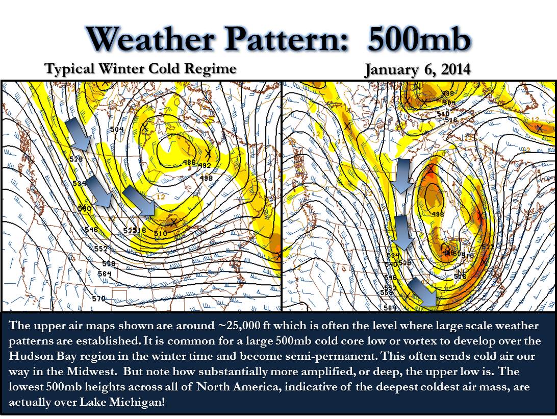
We also had a large snow pack in place across the Great Lakes and Midwest region, this reinforces the cold pattern. The final piece to the puzzle relates to the very popular weather term, the 'polar vortex'. Typically in winter, it's common for a low pressure system to set up shop in southern Canada that ushers in colder air. However in 2014 a piece of the polar vortex dislodged from where it typically sits and brings even colder air into the region. It's not uncommon for a piece of the polar vortex to make it's way close to the area. What was unusual was how long it stuck around, keeping temperatures far below average for a long time. The graphic below, courtesy of the National Weather Service, shows the difference between a normal cold snap, and one due to the polar vortex. You can see a big difference between the two, with the one on the right showing a very amplified pattern that taps into arctic air.
While it will be quite a bit colder next week, it doesn't look to last too long. Temperatures look to return to return to more seasonable temperatures later in the month.
No comments:
Post a Comment